Petungkriyono and the Guerrilla Government of the Pekalongan Residency, 1947–1949
An 81st Anniversary Gift of the Republic of Indonesia to the People of Petungkriyono
17 Agustus 2026
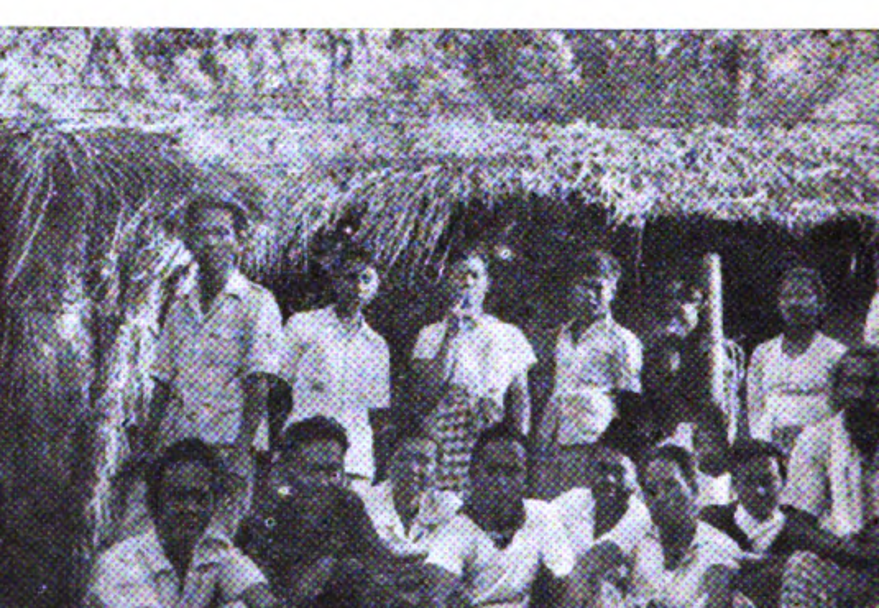
Photo 1. “New headquarters in Ketjamatan Petungkrijono Pekalongan.” In the original caption, the three figures seated from right to left are identified as R. Soedjono, Wignjosoeparto, and Mochtar. Source: Djawatan Penerangan Propinsi Djawa Tengah, Republik Indonesia: Propinsi Djawa-Tengah (1953), Pekalongan photographic documentation.
“When the Republic lost a safe space in the cities, Petungkriyono became one of the places that gave it room to remain alive.”
A Photograph That Changes How We See Petungkriyono
There is a photograph in the official book Republik Indonesia: Propinsi Djawa-Tengah, published in 1953. The building is modest. There is no district pavilion, resident’s office, official vehicles, or facilities normally associated with a governmental center. Yet the caption is remarkably clear: “Markas baru di Ketjamatan Petungkrijono Pekalongan.”1
Even more important are the people in the photograph.
They were not merely soldiers resting in the mountains. The official caption identifies R. Soedjono, an official serving as Resident of the Republic of Indonesia in Pekalongan; Wignjosoeparto, Head of the Pekalongan Residency Information Service; and Mochtar, an official responsible for economic affairs who later became Regent of Klaten. Their presence indicates that Petungkriyono once served as a working space for government officials, rather than merely as a military refuge.
This finding matters for how we understand local history.
Petungkriyono does not need to be exaggerated as the “capital of the Republic” to possess historical significance. The available sources instead point to something more concrete: when the Pekalongan Residency government could no longer operate normally from the urban center, elements of the state—civil officials, military command, information, communications, and administration—were able to survive from this mountainous area.
Yet a guerrilla state did not exist in an empty space. It could function only within a community that provided the social environment necessary for mobility, communication, and everyday life. The history of Petungkriyono during the Revolution should therefore be understood as the history of an encounter between a moving state and the mountain communities in which that state survived.
Petungkriyono’s historical pride is not built on legend alone. Documents, photographs, dates, places, and the names of historical figures already speak with considerable force.
1947: The Republic Moves into the Mountains
Petungkriyono’s role became increasingly visible when the First Dutch Military Aggression reached Pekalongan in late July 1947. After Comal was occupied on 28 July 1947, the Republic’s defenses in the lowlands became increasingly difficult to maintain. Elements of its forces subsequently moved southward through Sragi, Kesesi, Kajen, Bojong, and Petungkriyono.2
Local historical research on the First Dutch Military Aggression records that elements of the Republican forces in retreat reached Dukuh Mudal, Yosorejo Village, Petungkriyono. There, they stopped and reorganized their remaining strength before moving toward the border areas of Banjarnegara and Wonosobo.
Mudal was not a major town, and Yosorejo was not a permanent command center. Yet in guerrilla warfare, places of this kind were precisely what mattered as spaces for consolidation, logistics, information, and movement.
At this stage, Petungkriyono began to emerge as part of a strategic corridor between the Pekalongan lowlands and the Republican hinterland around Wonosobo–Dieng. Geography that appeared to be a form of remoteness in peacetime became a strategic advantage.
Yet physical terrain alone cannot explain the ability of troops to survive and move. Footpaths had to be known, places to stay had to be available, news had to circulate, and everyday needs had to be met.
The available sources do not yet allow us to identify, one by one, the people of Petungkriyono who performed these functions. Therefore, this social role should be understood as a structural prerequisite for government and guerrilla operations, rather than as a claim that the entire population acted uniformly.
Those Who Went into the Mountains Were Not Only Soldiers
The history of the Revolution becomes too narrow if it is viewed solely through the movement of battalions and weapons. When the Republic lost safe spaces in the lowlands, the government moved as well. Officials moved, documents moved, communication networks moved, and even radio equipment was evacuated.
Official Republican sources record the movement of a radio station from Pekalongan through Kedungwuni, Doro, Yosorejo, Gumelem, and onward to Batur and Dieng.1 Two points along this route—Yosorejo and Gumelem—were located in Petungkriyono.
In the late 1940s, moving a radio station meant moving transmitters, power sources, technicians, and supporting equipment. Radio was political infrastructure: through radio, the Republic could continue transmitting news, instructions, and messages of legitimacy.
Thus, when the radio passed through Yosorejo and Gumelem, it was not merely a piece of equipment that was moving. Part of the state’s infrastructure was moving.
Petungkriyono became one of the sections of the route through which the “voice of the Republic” passed through the mountains.
The Republic Did Not Survive Alone
State archives have a recognizable tendency: they record the names of those who led, signed documents, held office, or commanded a unit. That is why we know Brotosewojo, Soedjono, Soehadi, Wignjosoeparto, and Mochtar.
By contrast, documents are far less likely to mention the people who provided places to stay, knew forest paths, carried messages, moved equipment, or simply kept a headquarters secret. The absence of their names from the archives does not in itself mean that they played no role in history.13
A guerrilla government could not materially survive through an official structure alone. Headquarters needed food and shelter; officials needed relationships with villages; troops needed information about routes and enemy movements; and the radio passing through Yosorejo and Gumelem had to be transported by people and required places to stop.
For Petungkriyono, we do not yet have a list of the residents who performed these tasks. Therefore, this article does not turn plausible logistical necessities into a list of unproven individual facts.
What can safely be stated is that the presence of government and military forces in the mountains required a social environment that allowed them to survive.
It is also important not to romanticize the term “the people.” Village communities during wartime were not groups that always possessed free choices or shared the same attitudes. Support for the Republic could arise from political convictions, family ties, village solidarity, or security concerns; at the same time, residents faced fear, pressure, food shortages, and the risk of retaliation from both sides.
The history of the people of Petungkriyono therefore needs to be written as a history of human beings living under wartime conditions—not as an anonymous mass that always agreed, but as a community living in a space where two competing powers were struggling for control.
It is precisely from this perspective that Petungkriyono’s significance becomes greater.
These mountains were not an empty stage temporarily borrowed by Republican officials. They were a living space: villages, houses, roads, fields, family relationships, and local knowledge that shaped the environment in which a moving government could operate.
The archives we possess do not yet provide enough names to write biographies of local supporters, but they give us strong reasons not to erase the community from the story of the guerrilla state.
When the Residency Government Established Its Headquarters in Petungkriyono
Following the Second Dutch Military Aggression in December 1948, Petungkriyono’s position became much clearer.
An official 1953 source explains that the Pekalongan Residency government was strengthened and militarized. Its military element was led by Major Brotosewojo, while R. Soedjono served as Head of the Civil Staff as well as acting Resident of Pekalongan.3
The structure of the staff demonstrates that what survived in the interior was not merely a combat command.
Soemantono was responsible for the secretariat; Mochtar handled economic affairs; Wignjosoeparto was responsible for social affairs and information; Wirjosepoetro handled political affairs; H. Zanawi handled religious affairs; Soebowo handled policing; and Slamet Soenarjo served as liaison. Each section had its own assistants.
This list is highly significant for the history of Petungkriyono. It shows that a Residency apparatus continued to maintain administrative, economic, political, information, religious, policing, and communication functions under wartime conditions.
The same source later states that the structure “kembali bermarkas didaerah Patungkriono”.3
Petungkriyono should therefore be understood as a space of mobile government. The term “headquarters” is more appropriate than “capital”: its status was emergency-based, its location was highly mobile, yet the functions of the state continued to be carried out.
At the same time, the existence of such a headquarters always had a social dimension. The Residency apparatus did not stand upon an empty landscape; it operated amid villages with inhabitants, food resources, mobility routes, and information networks.
We cannot yet measure the extent of support provided by the Petungkriyono community. But methodologically, we should also not write the history of the headquarters as though the surrounding population did not exist.
14 May 1949: Curugmuncar Enters the History of the Republic
On 14 May 1949, one of the strongest pieces of evidence concerning Petungkriyono’s position emerged.
The official Republican book records:
“Pada tanggal 14 Mei 1949 di Tjurugmuntjar, Ketjamatan Patungkriono, dibentuk pemerintah militer untuk Kabupaten Pekalongan dibawah pimpinan Major Soehadi dari C.A. IV (Airi).”4
Tjurugmuntjar is Curugmuncar.
This record provides four particularly strong elements at once: a date, a location, an institution, and a leader.
On 14 May 1949, Curugmuncar became the site where the Military Government of Pekalongan Regency was established under Major R. Soehadi of CA IV/ALRI.
Curugmuncar did not merely enter the history of Petungkriyono. On 14 May 1949, it entered the history of the Republican government in Pekalongan.
This needs to be distinguished from the Military Government of the Residency.
Petungkriyono was connected to two layers of Republican institutions: the Residency level, with Brotosewojo and Soedjono as central figures; and the Pekalongan Regency level, whose military government was established in Curugmuncar under Soehadi.
Thus, in 1949, the Petungkriyono area became a space where the Residency structure, Regency structure, and Republican military networks intersected.
Major Soehadi and CA IV: The Navy in the Mountains
The presence of an ALRI officer in the mountains may sound unusual when viewed through the structure of the modern military. Yet during the Revolution, ALRI elements from the Tegal and Pekalongan areas had to move inland after losing many positions along the north coast.
In subsequent reorganizations, these elements operated as CA IV in the areas of Pemalang, Pekalongan, Batang, and the northern slopes of the mountain region.5
The operational traces of CA IV show that Curugmuncar was not an isolated point.
In May 1949, fighting took place in Kalibening, and on 25 June the CA IV base at Karangpucung-Watukumpul came under Dutch pressure; an intelligence officer, Lieutenant Sutomo, was killed.
The broader context reveals a Republican military network attempting to penetrate the northern coastal region once again.
Republican sources describe this phase with a particularly characteristic phrase:
“Tentara kita terus merembes masuk ditengah-tengah musuh.”4
The word “merembes”—literally suggesting seepage or infiltration—describes a strategy that did not depend solely on frontal attacks.
The Republic returned through villages, inland routes, local networks, relationships with village heads, and underground government structures.
1 August 1949: The Guerrilla Government Was Still Issuing Orders
Evidence from Dutch archives reinforces this picture.
The NEFIS/CMI collection contains a document dated 1 August 1949 consisting of an announcement by the Military Government of the Pekalongan Residency. The archival description states that the announcement concerned the severing of relations between Indonesian citizens and Dutch institutions.6
The complete text of the document still needs to be examined before its detailed contents can be quoted. However, its existence demonstrates that in early August 1949 the Military Government of the Pekalongan Residency was not merely surviving symbolically: it was still issuing political instructions to the population.
This is one of the distinctions between armed guerrilla warfare and guerrilla government.
From Petungkriyono toward Doro
The official 1953 source states that the Residency government subsequently moved its “markas madju ke depan” to a place identified as “desa Teluk, Ketjamatan Doro,” and later to Wonopringgo.
At this stage, the head of the Military Government was replaced by Lieutenant Colonel Sarbini.7
The name “Teluk” needs to be treated cautiously.
So far, an administrative village named Teluk in Doro has not been independently identified in the village lists and historical maps that have been examined. It may have been a micro-toponym that subsequently disappeared, a loose use of the term “village,” or a textual error.
Therefore, “Teluk” should be retained as the name written in the source, rather than treated as a definitively identified modern location.
Yet this uncertainty regarding the micro-toponym does not erase the larger pattern.
The Petungkriyono–Doro corridor is geographically and historically real. What can be seen is the direction in which the center of government moved: from a mountainous base toward areas increasingly close to the lowlands.
The movement of location was accompanied by a change in command, meaning that the process also constituted an institutional reorganization.
19 August 1949: Dutch Archives Record the Shift in Power
Did the Dutch observe the same change?
The Nationaal Archief indicates that they did.
Within the Algemene Secretarie file 2.10.14 inv. 3049 is a secret report by the Resident of Pekalongan dated 19 August 1949, entitled “Militaire en politieke situatie in het Regentschap Pekalongan”.89
The report records that Republican forces moved northward from the Batur area and were present, among other places, around Kedungwuni, Pekalongan, Batang, Doro, and Kajen.
This is important confirmation from the opposing side: movement from the mountainous hinterland toward the north was indeed taking place.
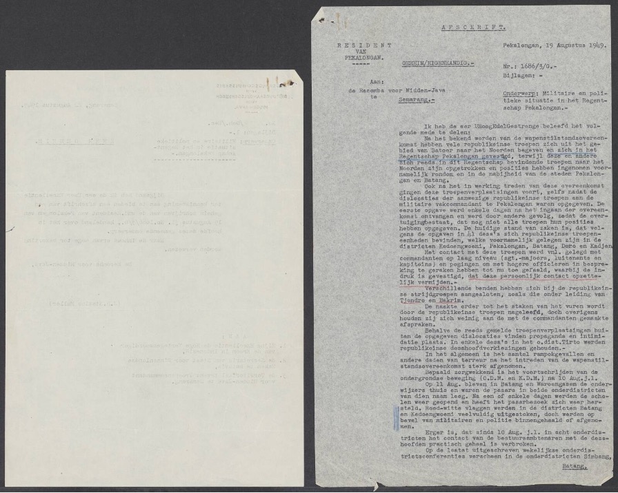
Document 1. The first page of the secret report of the Resident of Pekalongan, 19 August 1949, “Militaire en politieke situatie in het Regentschap Pekalongan”. Source: Nationaal Archief, Den Haag, Algemene Secretarie, toegang 2.10.14, inv. 3049, scan 0128.
The report becomes even more significant when it discusses village administration.
In Doro, not a single lurah was reported to have attended an administrative conference. Meanwhile, the conference of the Wonopringgo onderdistrict had to be held in Kedungwuni and attracted very limited attendance.
From around 10 August onward, in several onderdistricts, relations between Dutch officials and village heads had effectively been severed.9
For the colonial government, such a situation meant the loss of one of the most important links in its chain of authority.
A state does not exist only through soldiers and offices; it requires village heads, messengers, people who carry out orders, and inhabitants who recognize its authority.
Therefore, changes at the village level must be understood as part of a transformation in political power, rather than as mere administrative details.
When Villages Began to Determine Who Held Power
The report of the Resident of Pekalongan demonstrates that the struggle over space in August 1949 reached the level closest to the everyday lives of ordinary people.
In Doro, not a single lurah attended the conference organized by the Dutch government. In Wonopringgo, the onderdistrict conference had to be moved to Kedungwuni and was attended by only a small number of village heads.
The same report records that from around 10 August, relations between Dutch officials and village heads in several onderdistricts had effectively been severed.9
The absence of these lurah did not automatically prove that every village head had become an active supporter of the Republic. Their motives were not fully documented and could have varied.
Yet from the perspective of the history of power, the consequence is clear: the Dutch administration lost an important intermediary connecting it to the villages.
When a lurah no longer appeared when summoned, the colonial government might still possess offices and troops, but its ability to govern the population was beginning to weaken.
The 19 August report also records the increasingly visible display of the red-and-white flag in several areas.
This symbol was important because a flag did not alter military lines, but it expressed legitimacy.
In such a context, the Republic’s return from the mountains did not occur only through the movement of commanders and headquarters. It also occurred from below: through village heads choosing whether or not to appear, through information channels, through symbols being displayed, and through changing perceptions of which government was regarded as possessing authority.9
Direct evidence concerning the behavior of the people of Petungkriyono itself remains thinner than the evidence available for Doro and Wonopringgo.
That distinction must be preserved.
Yet because Petungkriyono was a headquarters area, a radio corridor, and a route of consolidation, the social history of this region should become an equally important research agenda alongside the search for dates of headquarters movements: who served as intermediaries, which houses were used, how food and information moved, and how residents navigated the risks of living between the Republic and the Dutch.
Republican sources described their forces as “seeping in.” Dutch reports reveal the consequences: in several areas, the colonial government’s administrative network was beginning to lose its ability to function.
24 August 1949: Wonopringgo Becomes a Republican Stage
On 24 August 1949, official Republican sources record a conference of the Military Government and, in particular, the Information Service of the Pekalongan Residency in Wonopringgo.
A commemoration of the fourth anniversary of the ALRI/TNI also took place at the same location.10
Elsewhere, the 1953 source uses the date 24/25 August; this internal variation should be preserved as part of source criticism rather than forcibly standardized.
Compared with 14 May, the change was substantial.
Three months earlier, the Military Government of Pekalongan Regency had been established far away in Curugmuncar. By the end of August, the Republican government structure was already capable of holding a conference in Wonopringgo.
The distance between these two locations provides a concrete measure of the Republic’s renewed expansion of political space.
Brotosewojo and Soedjono: From the Mountain Headquarters Back to Pekalongan
The movement of the government center can be traced through the movements of its officials.
Major Brotosewojo and R. Soedjono, who had previously operated the government under guerrilla conditions and were directly associated with the Petungkriyono headquarters, later became involved, together with Republican staff, in negotiations with the Dutch concerning the implementation of a ceasefire at the Pekalongan Regency pavilion.11
The official source describes the group traveling from Wonopringgo to Pekalongan as receiving a welcome from residents and floral arrangements along the route.
This language must, of course, be read as part of the Republican narrative of legitimacy.
Yet the people in this history should not appear only as a crowd welcoming officials as they returned to the city.
Dutch reports from several days earlier had already revealed a more significant layer: village heads who did not attend, disrupted village administrative relations, and increasingly visible Republican symbols.
The roadside reception therefore becomes more meaningful when understood as the culmination of a social process that had already been unfolding before the officials entered Pekalongan.
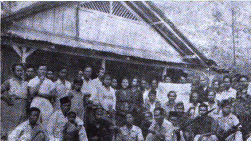
Photo 2. Following the ceasefire, Republican officials prepare to travel toward Pekalongan. The original caption identifies, from left: Mochtar, Soedjono, Wignjosoeparto, and Captain Soeprapto. Source: Djawatan Penerangan Propinsi Djawa Tengah, Republik Indonesia: Propinsi Djawa-Tengah (1953), Pekalongan photographic documentation.
The War in the Mountains Was Not Romantic
A moving government was always exposed to danger.
Another photograph in the 1953 publication shows the remains of the Republican headquarters in Lebakbarang after it had been burned by Dutch forces. The original caption states that all members of the staff survived.1
This photograph is important because it reveals the material reality of the situation: headquarters could be discovered, attacked, and destroyed; documents could be lost; communications could be disrupted; and the people working there faced real danger.
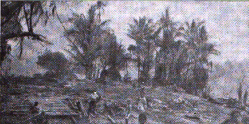
Photo 3. The remains of the Republican headquarters in the Lebakbarang area after being burned by Dutch forces. The original caption states that all staff members survived. Source: Djawatan Penerangan Propinsi Djawa Tengah, Republik Indonesia: Propinsi Djawa-Tengah (1953), Pekalongan photographic documentation.
The Road Home: Wonopringgo, Tangkil, Pekalongan
Following the Wonopringgo phase, the government center continued moving closer to the city.
The official source records that on 15 November 1949 the government was moved to Tangkil, in the Kedungwuni area.
On 1 January 1950, the Republican government finally officially re-entered Pekalongan City.12
Spatially, this entire story forms two almost symmetrical movements.
In 1947, the flow moved from Pekalongan toward Doro, Lebakbarang/Petungkriyono, and then into the Wonosobo hinterland.
In 1949, the direction reversed: from the hinterland toward Petungkriyono, Doro, Wonopringgo, Kedungwuni, and finally Pekalongan.
Petungkriyono stood between these two movements.
It received the retreating flow when the Republic lost the lowlands, but it later became one of the spaces from which the Republican government and forces prepared their return to the north.
In this sense, Petungkriyono was both a geographic and institutional hinge in the history of the Pekalongan Revolution.
Petungkriyono: Not the Periphery of the Revolution
Big histories are often written from cities: from government buildings, headquarters, battlefields, and negotiating tables.
Yet the Republic of Indonesia did not survive only in cities.
When cities were occupied or no longer safe, history moved into villages, forests, people’s homes, footpaths, and mountains.
For the Pekalongan Residency, one such space was Petungkriyono.
In 1947, Republican forces retreated through this area, and Mudal–Yosorejo became one of their points of consolidation.
The Republican radio moved through Yosorejo and Gumelem.
At a later stage, the Residency government re-established its headquarters in the Petungkriyono area.
And on 14 May 1949, Curugmuncar became the site where the Military Government of Pekalongan Regency was established.
There is no need to call Petungkriyono the “capital of the residency or regency” to make this history significant.
The verified facts already demonstrate that these mountains accommodated military, governmental, communication, and political consolidation functions during one of the most critical periods in the history of the Republic.
What Was Preserved in Petungkriyono?
Not merely military forces. In the available sources, what we can see surviving was a network of state functions:
- military and civilian leadership;
- government secretariat;
- economic affairs;
- information and political communication;
- political and religious affairs;
- policing;
- interregional relations and village networks;
- as well as military forces that enabled the entire structure to survive.
Therefore, the most appropriate term for describing Petungkriyono’s position is “a space of state continuity.”
When its formal center disappeared, the Republic did not cease to be a state; its functions shifted and were maintained in a more flexible form.
Yet this concept must be qualified: this continuity of the state took place within a social space.
Officials, radio operators, couriers, troops, and administrative structures required villages and the people around them.
Our sources are far clearer about the structure of officials than about ordinary residents, and this archival imbalance must be acknowledged rather than transformed into the erasure of the people’s role.
The Republic Survived Because There Were Those Who Protected It
We know the name of Major Soehadi because the official source records the establishment of the military government in Curugmuncar.
We know Soedjono because he served as Resident.
We know Wignjosoeparto and Mochtar because their positions were documented.
But the history of Petungkriyono is certainly broader than the names that managed to enter the documents.
The available archives are not yet sufficient to establish the names of the families whose homes were used as places to stay, who helped transport equipment, who knew the safe routes, or who carried news between villages.
Therefore, we must not create a list of local heroes unsupported by evidence.
But neither should we imagine that a guerrilla government could survive without the people around it.
Between these two errors—romanticization and erasure—there is room for a more honest history of ordinary people.13
For Petungkriyono, the task of the present generation is to fill this historical gap through research: collecting family memories, tracing old houses, route names, graves, photographs, letters, and testimonies that still survive, and then testing them against archival evidence.
In this way, ordinary people can reclaim their place within the story of the Republic—not as patriotic ornaments, but as historical actors whose roles can be substantiated.
An 81st Anniversary Gift of the Republic of Indonesia to the People of Petungkriyono
Eighty-one years after the Proclamation of Independence, one way to celebrate the Republic is to rediscover the places and communities that once enabled the Republic to survive.
Petungkriyono is one of them.
This pride should not be directed only toward commanders and officials whose names were recorded, but also toward generations of mountain communities who lived amid war and provided the social environment in which a moving government could function.
Not every fighter has a name that we still remember.
Not every house that once served as a headquarters still stands.
Not every old route can be identified.
Even the archives we possess are not sufficient to tell us who provided places to stay, food, information, labor, or protection for the Republican network.
But this very absence is a call for further research, not a reason to assume that ordinary people played no role.
The institutional traces remain, and so do the place names:
Yosorejo, Gumelem, Mudal, Curugmuncar, Petungkriyono.
The people of Petungkriyono therefore have every right to be proud of their homeland—not because its history needs to be exaggerated, but because the historical reality itself is already significant.
At a time when the Republic of Pekalongan had lost safe space in the cities, these mountains became one of the places that allowed the state to continue moving, communicating, organizing its strength, and governing.
And all these functions took place amid the life of a community, not on an empty map.
In 1947, the Republic moved into the mountains so that it would not disappear. In 1949, from that same mountain network, it began moving back to reclaim its governmental space.
So if one day the children of Petungkriyono ask what their birthplace has to do with the Republic of Indonesia, we no longer need to answer with legend.
We can answer with archives:
When the Republic of Pekalongan lost its safe space in the city, Petungkriyono became one of the places that gave it room to remain alive.
But we must add one more sentence:
That history does not belong only to the officials whose names were written down. It also belongs to the mountain communities living around the headquarters, routes, and villages where the Republic defended itself—even though many of their names have yet to be discovered.
HAPPY 81ST ANNIVERSARY OF THE REPUBLIC OF INDONESIA
For all the people of Petungkriyono: preserve the memory of this land, including the names of ordinary people whose stories have yet to be found.
Key Timeline
| Date / Period | Event |
|---|---|
| 28 July 1947 | Comal was occupied; Republican forces moved southward. |
| 1947 | Forces moved through Sragi–Kesesi–Kajen–Bojong toward Petungkriyono; Mudal–Yosorejo became one of the points of consolidation. |
| 1947 | The Republican radio moved through Doro–Yosorejo–Gumelem toward Batur–Dieng. |
| 1948–1949 | The Pekalongan Residency government was militarized under Major Brotosewojo and R. Soedjono, and later re-established its headquarters in the Petungkriyono area. |
| 14 May 1949 | The Military Government of Pekalongan Regency was established in Curugmuncar under Major Soehadi, CA IV/ALRI. |
| 25 June 1949 | The CA IV base at Karangpucung–Watukumpul came under Dutch pressure; Lieutenant Sutomo was killed. |
| 1 August 1949 | The Military Government of the Pekalongan Residency was recorded as issuing an announcement to the population. |
| c. 10–19 August 1949 | The Dutch administrative network weakened in several areas; Doro and Wonopringgo were among the areas strongly affected. |
| 19 August 1949 | The Resident of Pekalongan reported that Republican forces were moving northward from Batur and were present, among other places, in Doro, Kajen, Kedungwuni, Batang, and Pekalongan. |
| 24/25 August 1949 | Wonopringgo became the site of a Residency government conference; the 1953 source contains an internal variation between 24 and 24/25 August. |
| 15 November 1949 | The government was moved to Tangkil, Kedungwuni. |
| 1 January 1950 | The Republican government officially returned to Pekalongan City. |
Footnotes
- Djawatan Penerangan Propinsi Djawa Tengah, Republik Indonesia: Propinsi Djawa-Tengah (Jakarta: Kementerian Penerangan RI, 1953), terutama dokumentasi foto dan uraian sejarah Karesidenan Pekalongan. Publikasi resmi ini tersedia dalam domain publik melalui Wikimedia Commons.
- Slamet Dumadi dan Romadi, “Agresi Militer Belanda I Dalam Perspektif Sejarah Lokal untuk Pembelajaran Sejarah di SMA,” Historia Pedagogia 12, no. 1 (2023), DOI 10.15294/hisped.v12i1.68726. Artikel ini digunakan terutama untuk rekonstruksi pengunduran pasukan 1947 melalui Kajen–Bojong–Petungkriyono dan singgahnya unsur Republik di Mudal, Yosorejo.
- Djawatan Penerangan Propinsi Djawa Tengah, Republik Indonesia: Propinsi Djawa-Tengah (1953), hlm. 49. Bagian ini memuat struktur Pemerintah Militer Karesidenan Pekalongan, nama Mayor Brotosewojo, R. Soedjono, Soemantono, Mochtar, Wignjosoeparto, Wirjosepoetro, H. Zanawi, Soebowo, dan Slamet Soenarjo, serta pernyataan bahwa pemerintahan “kembali bermarkas didaerah Patungkriono”.
- Ibid., hlm. 49. Sumber menuliskan bentuk historis “Tjurugmuntjar” dan “Patungkriono” serta mencatat pembentukan Pemerintah Militer Kabupaten Pekalongan pada 14 Mei 1949 di bawah Mayor Soehadi dari C.A. IV (Airi/ALRI).
- Dinas Sejarah TNI Angkatan Laut, Jalakatha, Edisi 2 dan Edisi 3 Tahun 2021. Sumber institusional ini digunakan untuk konteks reorganisasi ALRI, CA IV, dan operasi unsur Angkatan Laut di wilayah Tegal–Pemalang–Pekalongan–Batang.
- Nationaal Archief, Den Haag, NEFIS/CMI, toegang 2.10.62, inv. 7060, “Bekendmaking Militair Bestuur Residentie Pekalongan over verbreken van betrekkingen van Indonesische burgers met Nederlandse instellingen,” 1 Agustus 1949. Isi lengkap dokumen belum digunakan; yang dipakai di sini adalah metadata katalog arsip.
- Djawatan Penerangan Propinsi Djawa Tengah, Republik Indonesia: Propinsi Djawa-Tengah (1953), hlm. 49. Sumber menyebut perpindahan “markas madju” ke “desa Teluk, Ketjamatan Doro”, kemudian ke Wonopringgo, serta perubahan Kepala Pemerintah Militer kepada Letnan Kolonel Sarbini. Identifikasi geografis “Teluk” masih belum final.
- Nationaal Archief, Den Haag, Algemene Secretarie van de Nederlands-Indische Regering en de daarbij Gedeponeerde Archieven, toegang 2.10.14, inv. 3049, “Pekalongan, 1947 sep. – 1949 aug.”
- Nationaal Archief, toegang 2.10.14, inv. 3049, laporan Resident Pekalongan, “Militaire en politieke situatie in het Regentschap Pekalongan,” 19 Agustus 1949, scan 0128–0129. Laporan ini digunakan untuk posisi pasukan Republik, gangguan hubungan administrasi Belanda dengan kepala desa, konferensi Doro dan Wonopringgo, serta pengibaran merah-putih di sejumlah wilayah. Pembacaan terhadap sikap lurah dilakukan secara hati-hati: ketidakhadiran mereka menunjukkan gangguan efektivitas pemerintahan Belanda, tetapi tidak dengan sendirinya membuktikan motif politik individual setiap kepala desa.
- Djawatan Penerangan Propinsi Djawa Tengah, Republik Indonesia: Propinsi Djawa-Tengah (1953), hlm. 49 dan 60. Satu bagian menyebut konferensi Wonopringgo pada 24 Agustus 1949, sementara bagian lain menggunakan tanggal 24/25 Agustus. Variasi internal ini dipertahankan sebagai bagian dari kritik sumber.
- Ibid., bagian akhir uraian Revolusi Karesidenan Pekalongan mengenai Mayor Brotosewojo, R. Soedjono, staf Republik, perundingan dengan pihak Belanda di pendopo Kabupaten Pekalongan, serta perjalanan rombongan dari Wonopringgo menuju Pekalongan.
- Ibid., hlm. 60. Sumber mencatat perpindahan pemerintahan ke Tangkil, Kedungwuni pada 15 November 1949 dan masuknya pemerintahan Republik secara resmi ke Pekalongan pada 1 Januari 1950.
- Artikel ini membedakan antara bukti langsung dan inferensi struktural. Sumber yang tersedia membuktikan keberadaan markas, aparat pemerintahan, pergerakan radio, dan operasi militer di koridor Petungkriyono; tetapi belum menyediakan daftar individu warga Petungkriyono yang menjalankan fungsi logistik, kurir, penyedia tempat singgah, atau perlindungan. Pernyataan mengenai kebutuhan pangan, tempat, jalur, dan informasi dipakai untuk menjelaskan prasyarat material pemerintahan gerilya, bukan untuk mengatribusikan tindakan tertentu kepada individu yang belum teridentifikasi.
Daftar Pustaka dan Arsip
- Djawatan Penerangan Propinsi Djawa Tengah. 1953. Republik Indonesia: Propinsi Djawa-Tengah. Jakarta: Kementerian Penerangan Republik Indonesia.
- Dumadi, Slamet, dan Romadi. 2023. “Agresi Militer Belanda I Dalam Perspektif Sejarah Lokal untuk Pembelajaran Sejarah di SMA.” Historia Pedagogia 12(1). DOI: 10.15294/hisped.v12i1.68726.
- Dinas Sejarah TNI Angkatan Laut. 2021. Jalakatha, Edisi 2 dan Edisi 3 Tahun 2021. Jakarta: TNI Angkatan Laut.
- Nationaal Archief, Den Haag. Algemene Secretarie van de Nederlands-Indische Regering en de daarbij Gedeponeerde Archieven, toegang 2.10.14, inv. 3049, Pekalongan, 1947 sep.–1949 aug.; termasuk “Militaire en politieke situatie in het Regentschap Pekalongan,” 19 Agustus 1949.
- Nationaal Archief, Den Haag. NEFIS/CMI, toegang 2.10.62, inv. 7060, Bekendmaking Militair Bestuur Residentie Pekalongan, 1 Agustus 1949.
- Wiyono, Suwardi, Hugiono, Asmito, dan Hartono Kasmadi. 1991. Sejarah Revolusi Kemerdekaan 1945–1949 Daerah Jawa Tengah. Jakarta: Departemen Pendidikan dan Kebudayaan, Proyek Inventarisasi dan Dokumentasi Sejarah Nasional.
Methodological Notes
Three issues have deliberately been left open.
First, the exact date of the headquarters’ movement from Petungkriyono toward the Doro area, and subsequently from Doro to Wonopringgo, remains unknown.
Second, “desa Teluk, Kecamatan Doro” is the form recorded in the 1953 source, but its location has not yet been independently identified.
Third, the sources discovered so far provide considerably more detail about officials and government structures than about the residents of Petungkriyono who sustained everyday life around the guerrilla network.
Therefore, this article does not transform the logistical and social necessities that were structurally required into claims about individuals or mass support that have not been substantiated.
Contributor:
Meiardhy Mujianto